An Icy Halloween
Today was the first cold day of the season, and the refreshing crispness of the air came with a stunning cirrus display high above Cape Cod. We were lucky to be right at the edge of a multi-state cloud band, where dense altostratus and cirrostratus clouds poured down a river of jet stream air. Because we were at one edge of this band, we were treated to all kinds of cirrus games as these high clouds danced around the main formation like crumbs falling off a pastry.
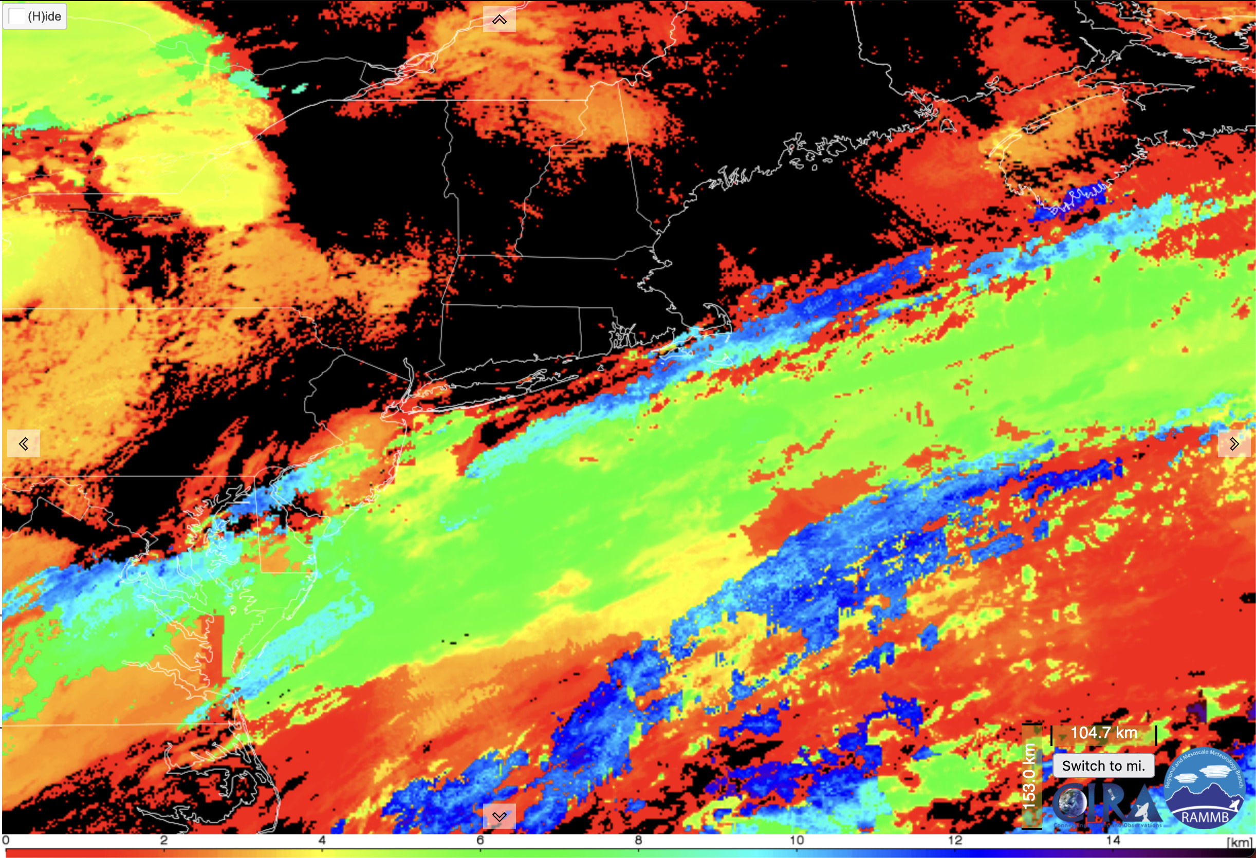
To set the scene, above is an animation of the day’s clouds over the Northeast from NOAA’s GOES-16 satellite. The central display is the river of mid-level clouds traveling northeast along the jet stream over the mid-Atlantic states. Notice how Cape Cod, where I am, spends the day going in and out of cloud cover. The clouds to the north, over New York and elsewhere, are also mesmerizing as they fill in with a rotating, rippling pattern of gravity waves.
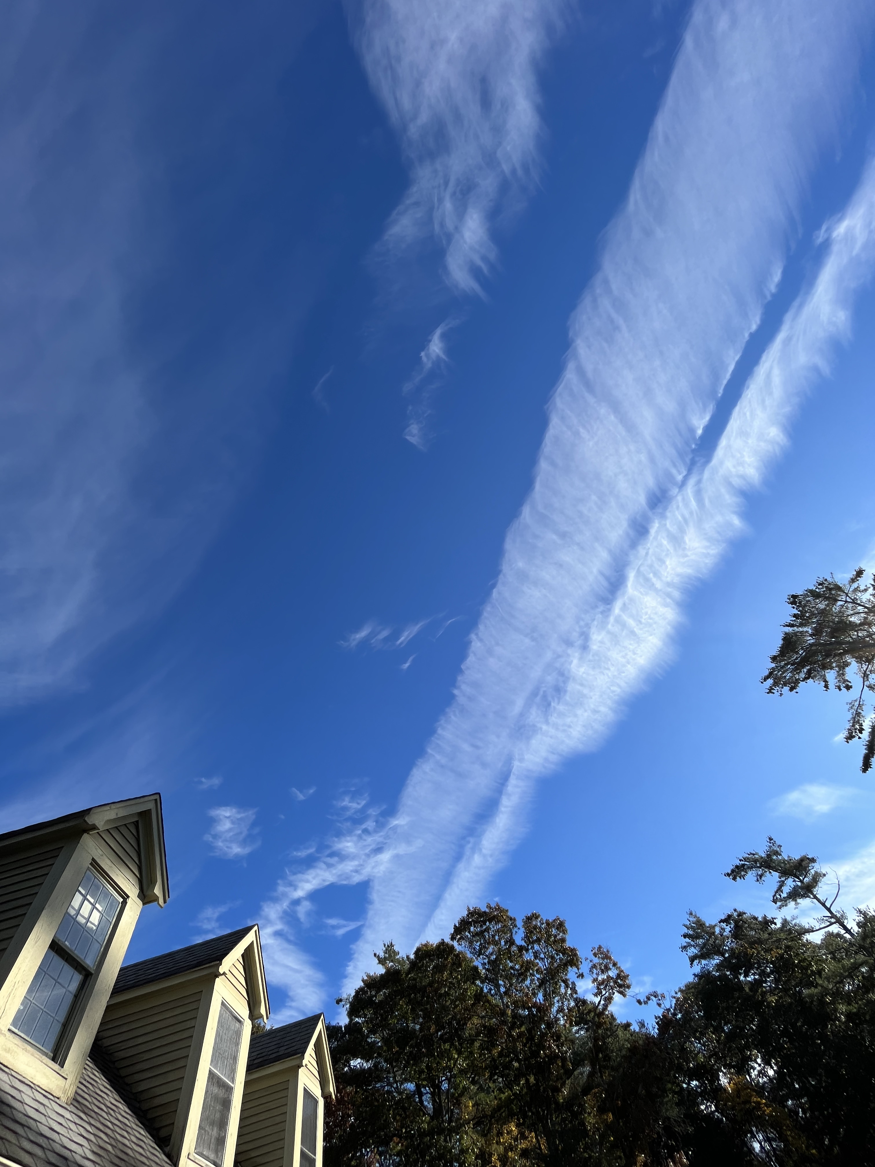
The morning on the Cape started with some striking contrails — the high clouds that are created by the water vapor exhaust of jet aircraft when conditions are right. The contrails in this case showed both that the upper levels were near saturation, and thus primed for a cirrus show, as well as the ripping jet stream winds that elongated the falling ice streaks in the contrails to make these “descending curtains” visible in the sky.
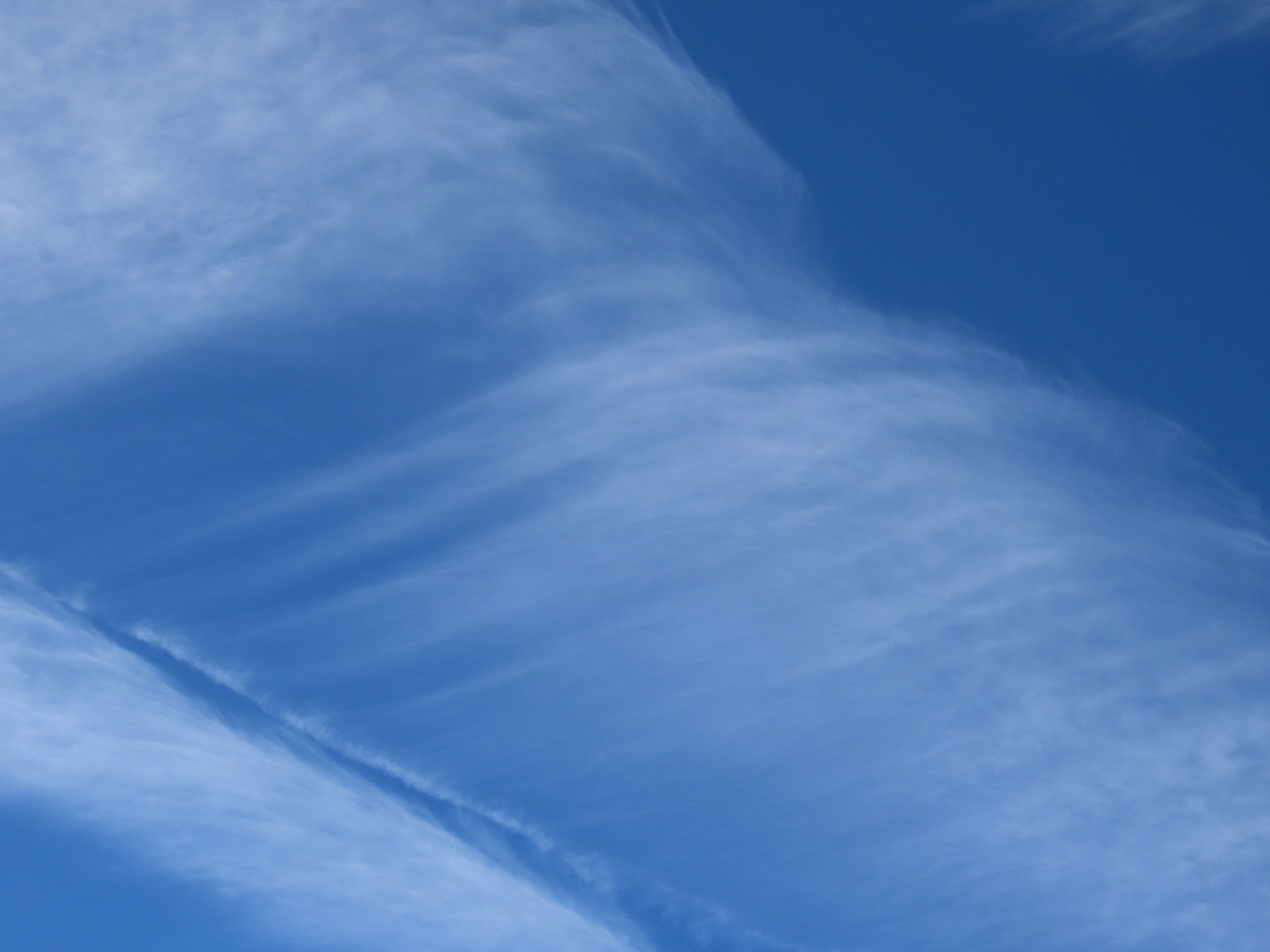
Not to be outdone by human magicians in the sky, the atmosphere followed this up with a sprawling field of cirrocumulus clouds: convective cells high in the atmosphere that look positively minuscule because they are so far away. The cells were incredibly fine, developing along the edge of the burlier altocumulus of the cloud river.
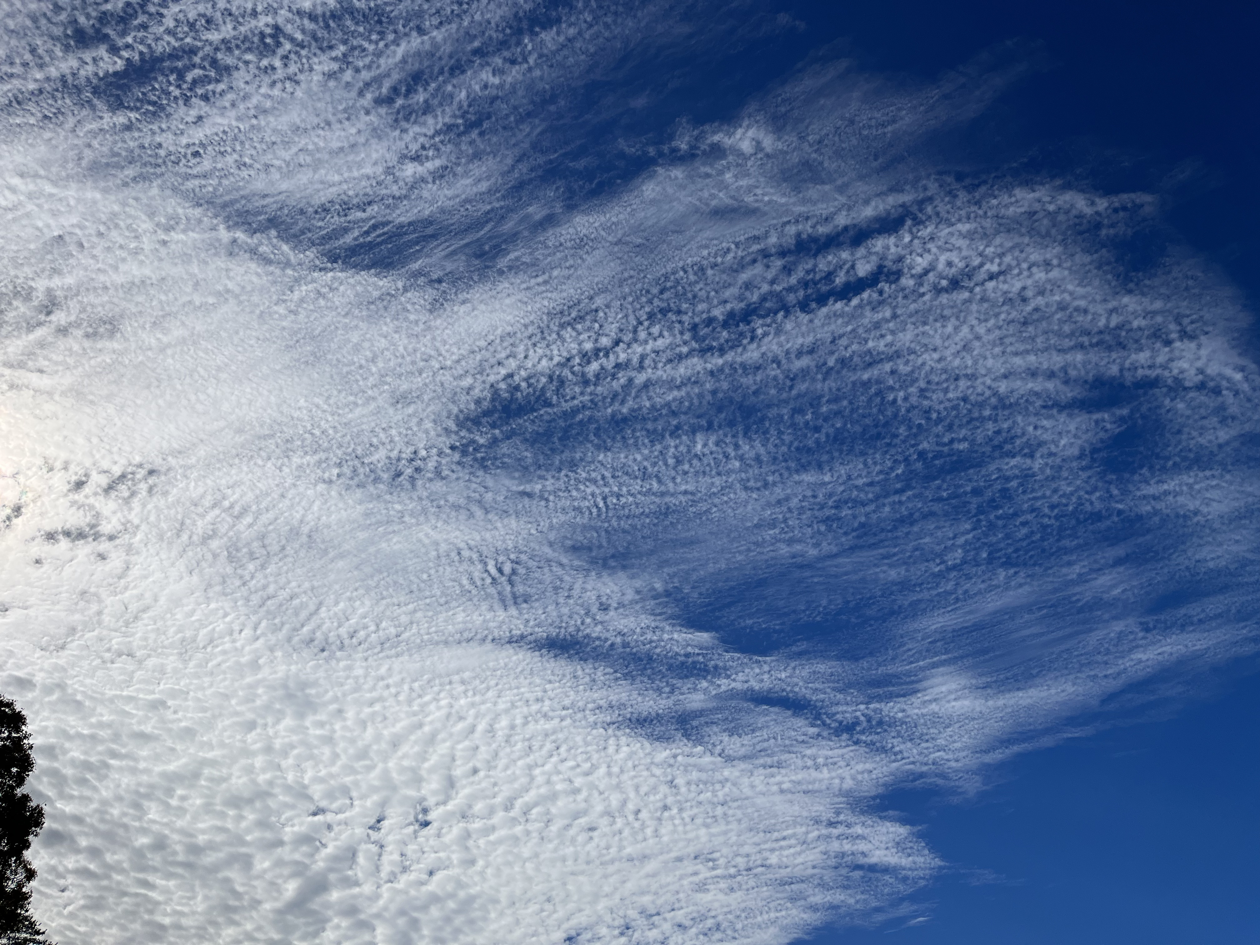
As the cirrocumulus clouds developed, some took on an appearance that reminded me of open cellular convection. This is when convective cells are made by clear patches surrounded by a cloudy boundary, rather than the more familiar closed cells, where cloudy patches are surrounded by a clear boundary. See the second picture below for a satellite image from the Pacific, where stratocumulus often mix these two modes of convection in beautiful patterns. I’m not sure whether cirrocumulus can exhibit open cellular convection, though. The patterns today might have just been closed cells that were at a variety of “life stages”. Either way, it’s always fun to have a reason to look at the open cells in the Pacific.
After the convective party was over, the atmosphere threw out a few more cirrus clouds that made it look as if it were combing its hair after all that hard work. Perhaps all of these great clouds were spooky costume changes on this final day of October?

One last image to show: the cloud top height, which helps give more context to the story. I saved it for last since it’s a bit more complicated to interpret. Read the caption below for the story. And have a happy Halloween!