An Iridescent Cyclone
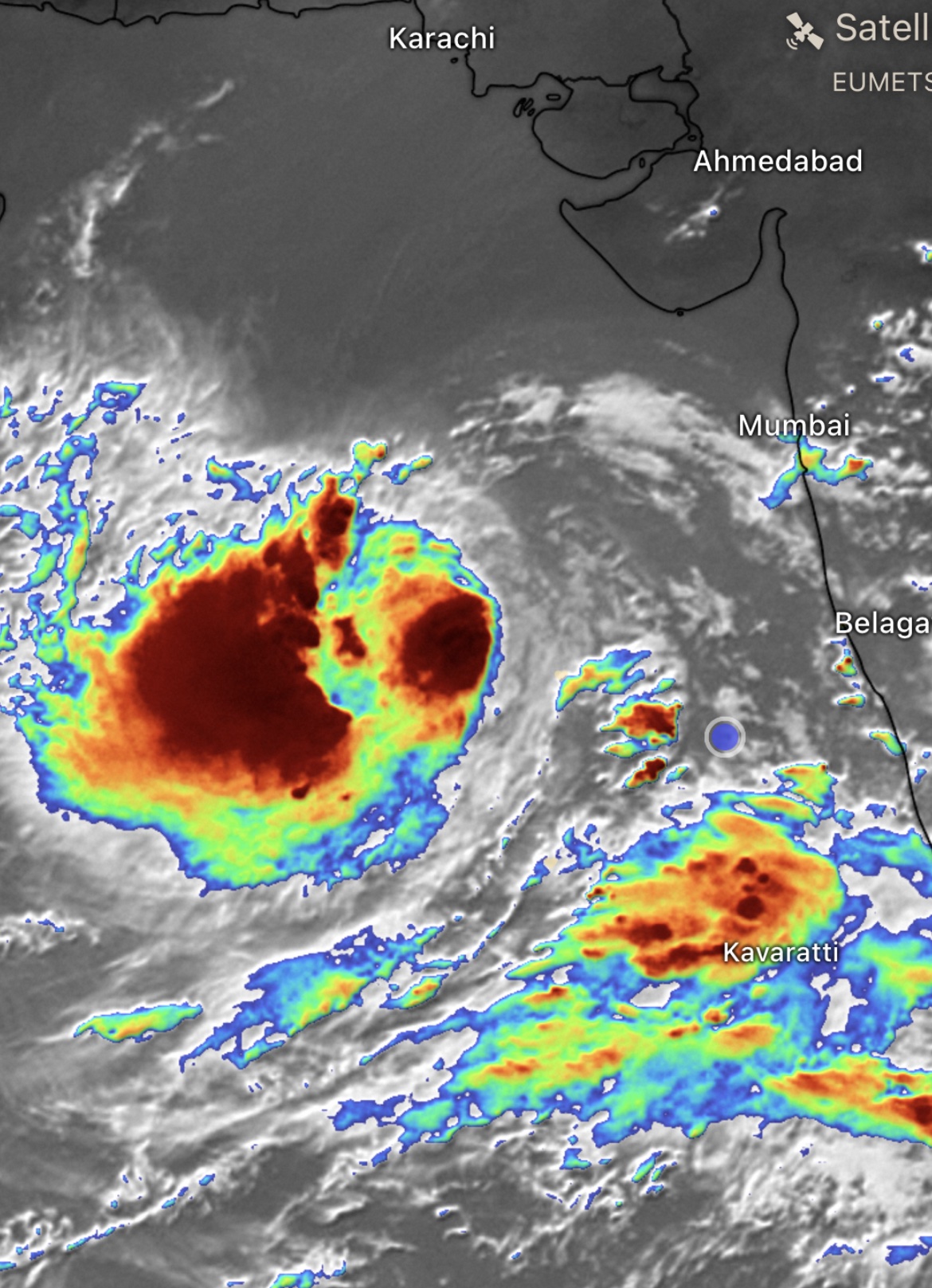
I was recently on board the research vessel Roger Revelle steaming southwest just outside the eastern edge of Cyclone Biparjoy in the Arabian Sea. Our research cruise was there to study the interaction between the ocean and the atmosphere during the onset of the South Asian monsoon, but this cyclone threw a wrench in the works as it decided to track directly over our original study area. We changed our plans so that we passed south of the storm on our way to a different location where we conducted our measurements. On the way, we passed one of the outer bands of the cyclone, where air was spiraling counterclockwise toward the center of the storm. From the ship, this band looked like a giant wall of cloud covering the horizon from end to end on our starboard side. Lightning periodically flashed in the wall, showing that the clouds were actively undergoing deep convection, building storm towers up into the sky.
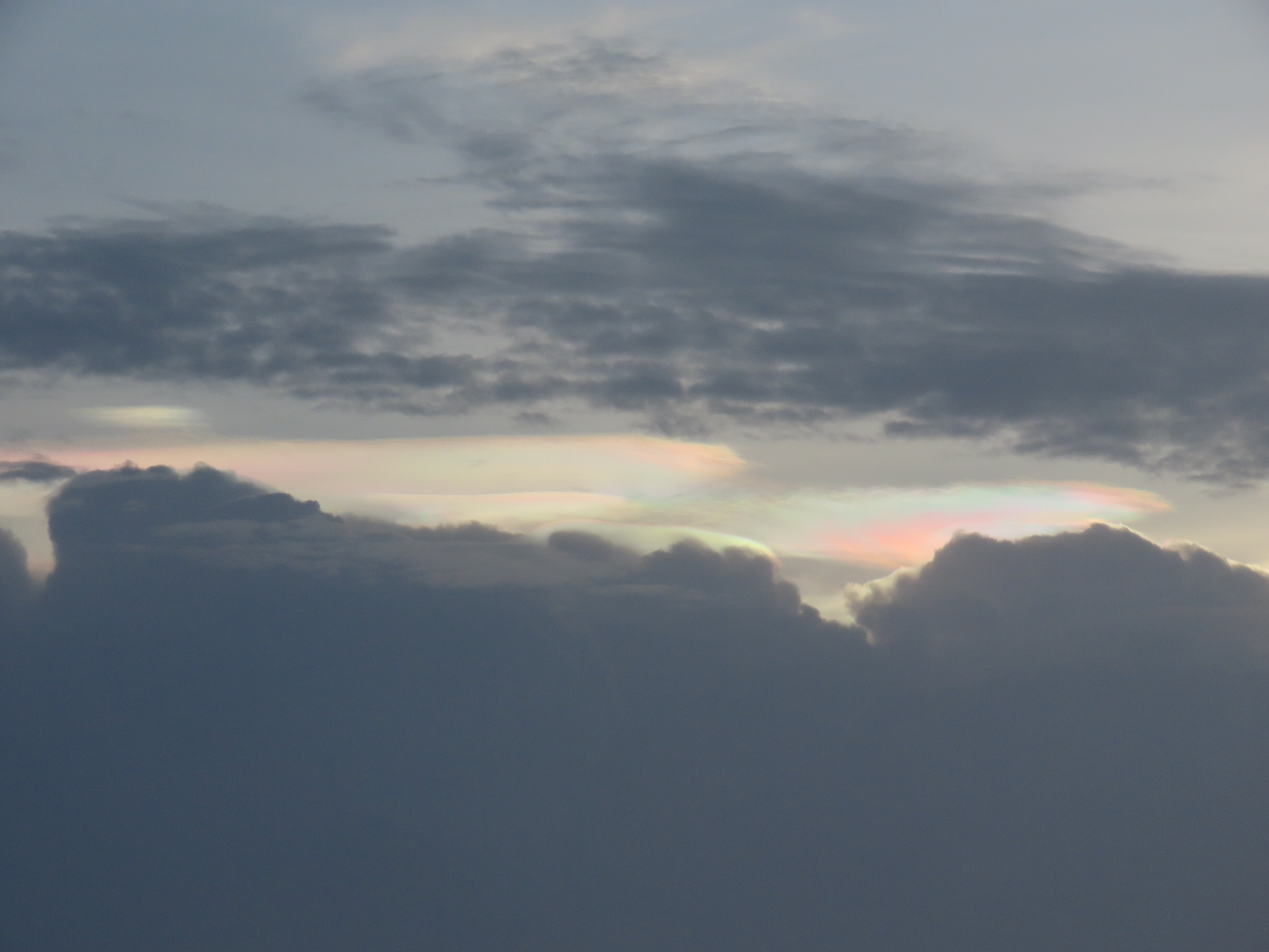
As the liquid water in these towers reaches the freezing level (typically around 5000 meters, or 16,500 feet, in this region), it freezes into ice. At the top of the towers, the clouds are completely frozen, creating cirrus caps over the deep convection. In this case, the cirrus clouds had a lenticular character that showed how they were being pushed vertically by the convection below. These haloes of cloud are indicative of strong upward motion (although we already knew that was present from the frequent lightning).
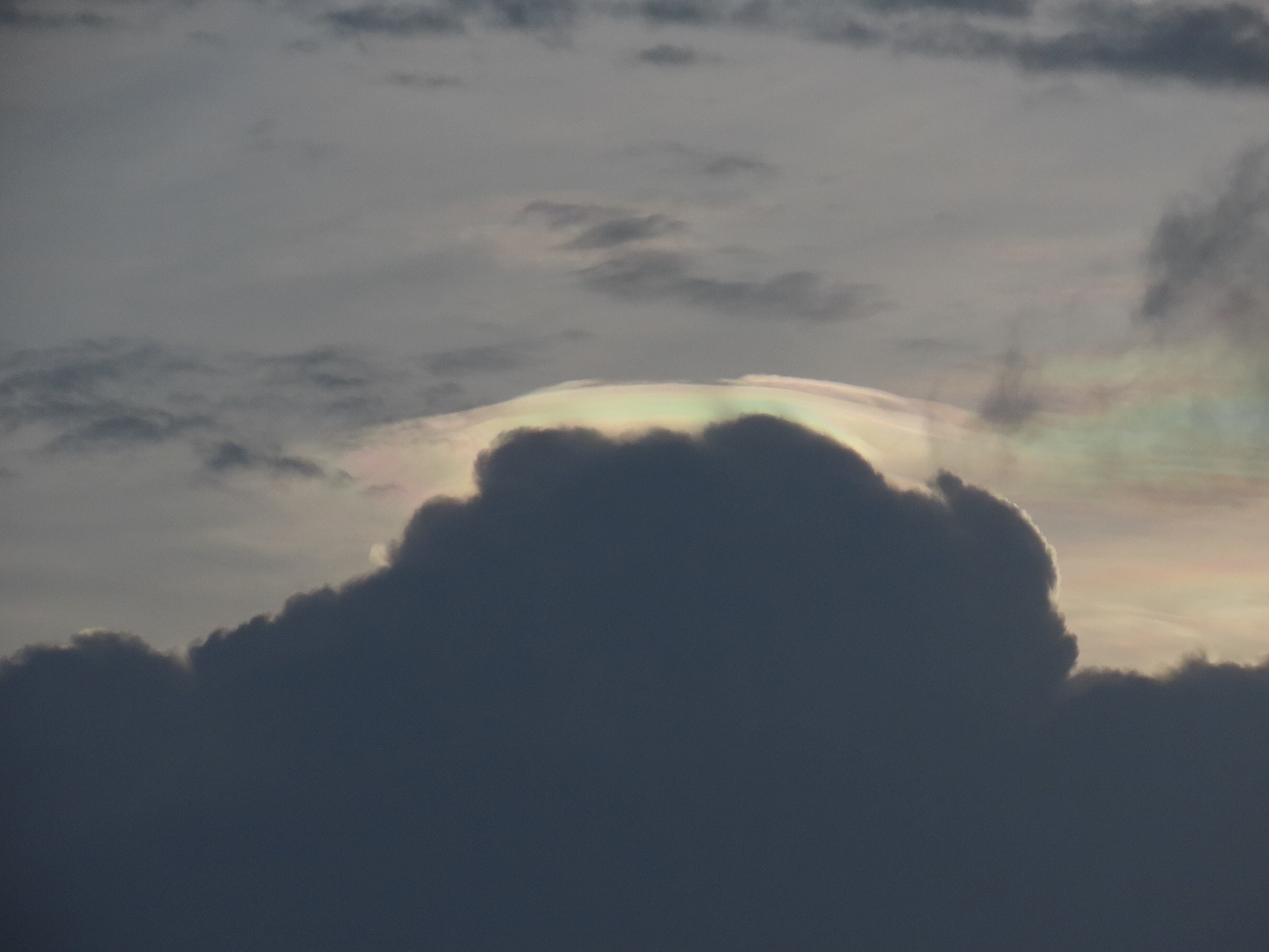
At this point, a few of us were sitting at a bench outside the ship’s main lab, getting ready for our evening science meeting. But then I noticed that these clouds weren’t everyday storm clouds: they were covered in rainbow colors! I pointed this out to my colleagues and we spent the next 30 minutes watching the clouds. The science meeting could wait.
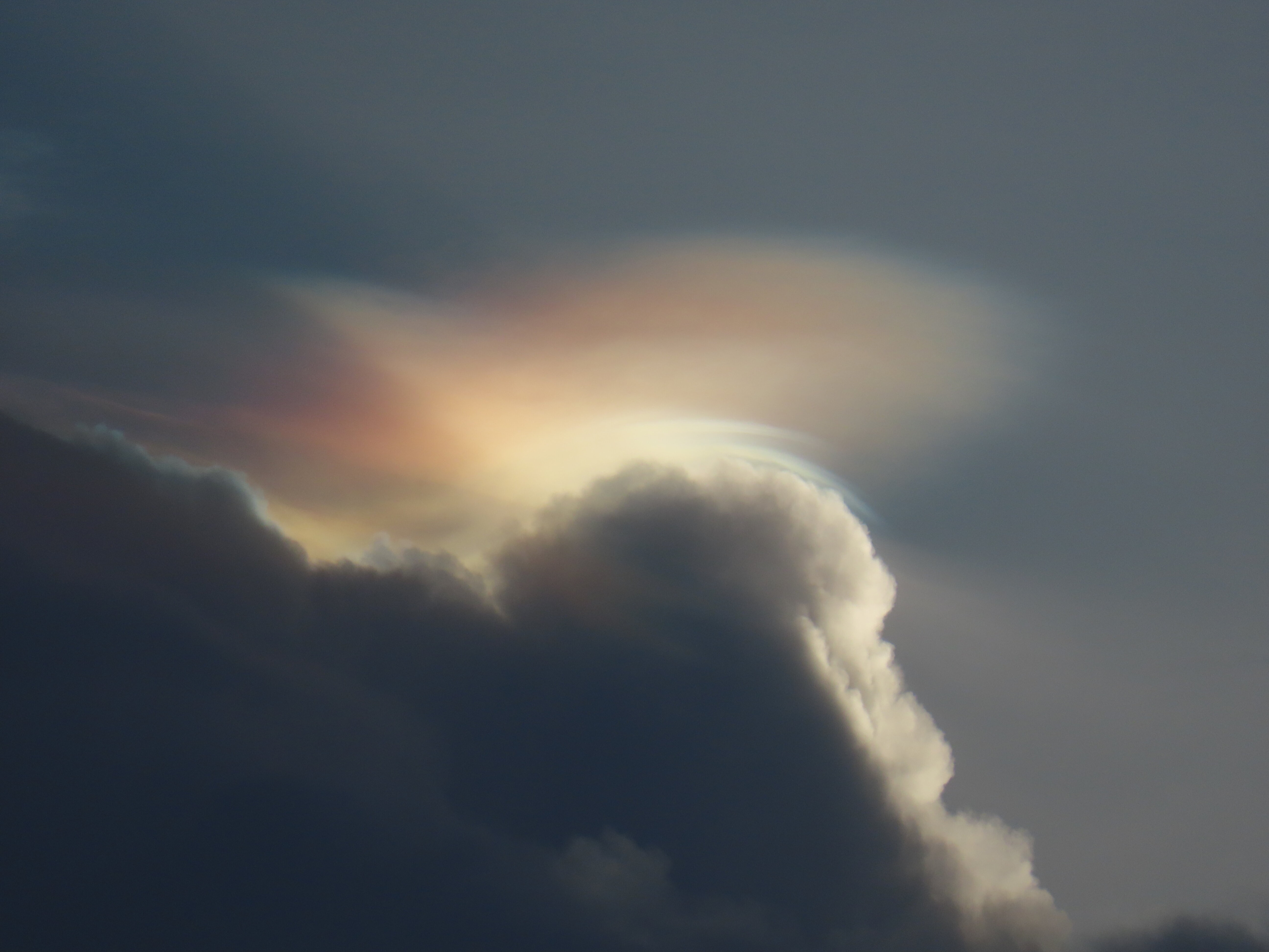
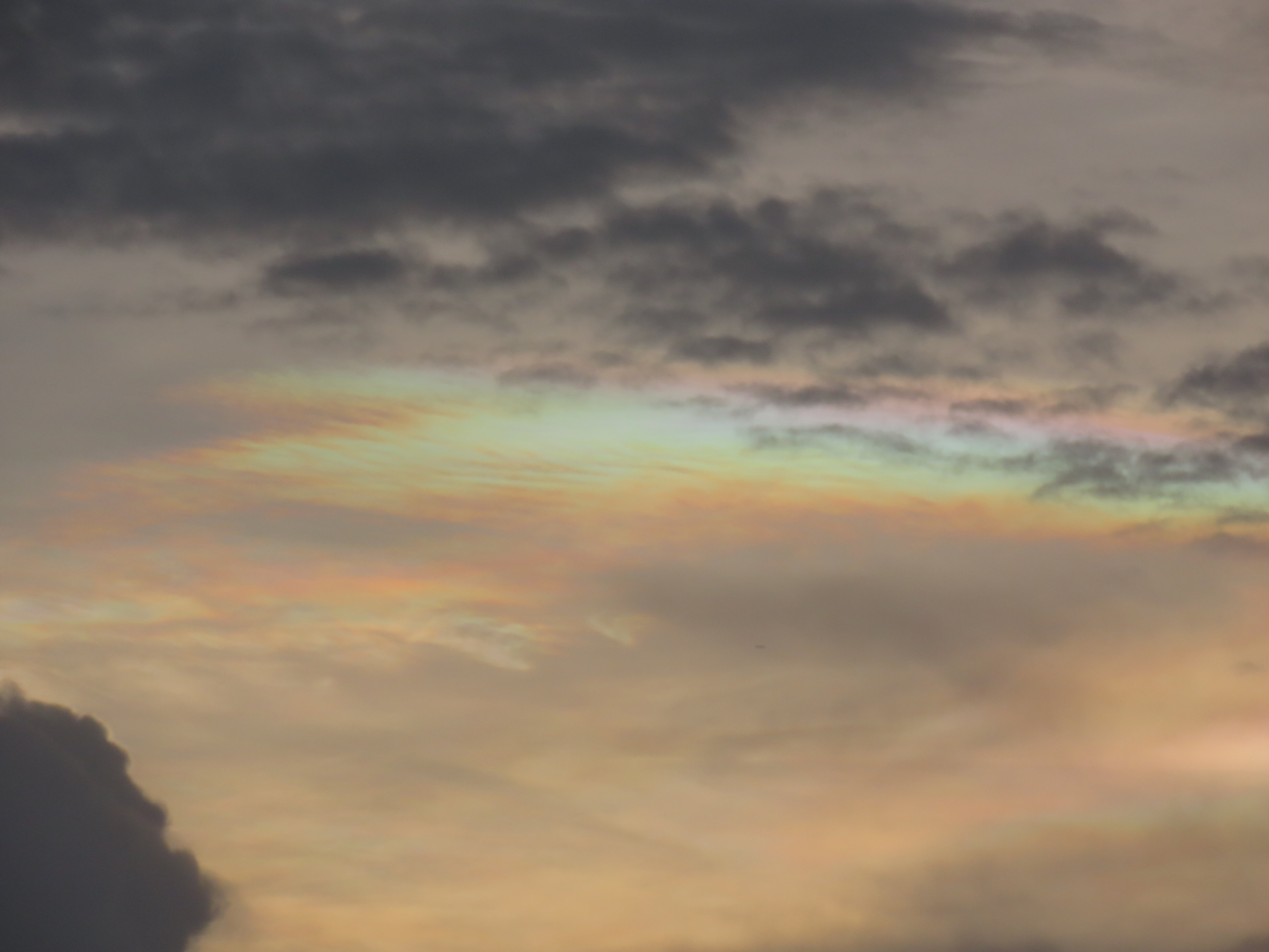
The iridescence in these clouds (also called irisation) is caused by diffraction and/or interference of sunlight by the constituent precipitation particles. For a cloud to produce irisation, it must be thin and composed of water or ice particles of a uniform size. These clouds were high enough that they were surely made of ice, though they must have been very young ice crystals. As ice evolves, the crystals combine and shatter into all different sizes (in fact, this is a primary way that we tell water droplets apart from ice crystals on weather radar).
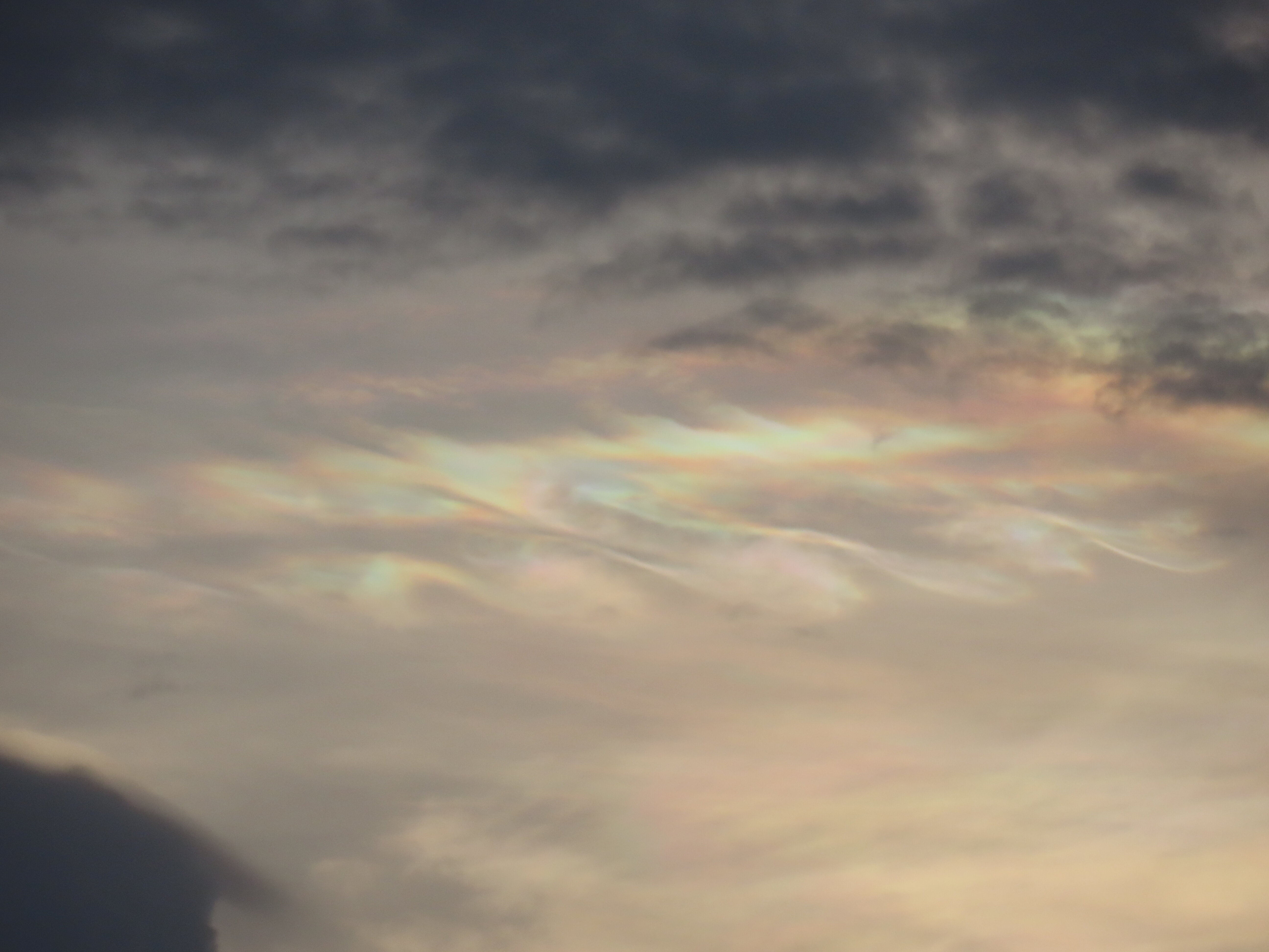
To add to the majesty, waves were visible in several of the iridescent clouds. These looked like Kelvin-Hemholtz billows, where wind shear (the change of wind with height) is able to overcome the stratification (the decrease of density with height), causing the air to spiral into a row of vortices that resemble breaking ocean waves. This phenomenon is quite common in the atmosphere and ocean, but it is only visible to the human eye when the conditions are just right so that a cloud can trace the fluid flow.
At this early point in the cruise, most of the science party was still getting our sealegs and we were not feeling tip-top. Most of us were on the scopolamine patch, a strong seasickness medication that helps you get your work done without feeling like you need to die, but also leaves you with the lingering feeling that it all was a dream. I wish I could have been fully in my right mind for this peak cloud experience, but I’m happy that I could see this rare sight at all. It was so amazing that it felt almost mystical. A colleague next to me said, “You can pay all the money to travel the world and see the wonders of nature, but beauty like this can only be stumbled upon.” Here’s hoping that I keep stumbling.